A city can be defined as a collection of neighborhoods with their own unique characteristics, culture and community dynamics that contribute to the diversity and functionality of the city in which they are located. This concept is relevant to urban planning because understanding the needs and identities of different communities can help develop more effective and inclusive policies. Urban neighborhoods typically offer a wide range of employment opportunities, educational institutions, and essential healthcare and other resources. These areas usually have well-developed public transportation systems, making it convenient to navigate without a car. Urban neighborhoods often have active cultural scenes and are composed primarily of residents of similar economic class and levels of civic responsibility. Housing options in urban areas may include apartments, condos, lofts, or townhouses, often with limited green space and higher population density. City life is typically fast paced and prone to noise and traffic congestion. They are often more diverse in terms of culture, demographics, and experiences, exposing residents to different perspectives and lifestyles. However, neighborhoods can also have deficiencies, leading to a lack of services and opportunities for residents.
By prioritizing neighborhoods, we can ensure that sustainable development initiatives are more effective, inclusive, and aligned with the everyday realities of the people they are designed to benefit. Integrating digital tools and sustainable practices is possible to enhance neighborhood livability, highlighting the need for local community participation and tailored metrics to address neighborhood-specific issues.
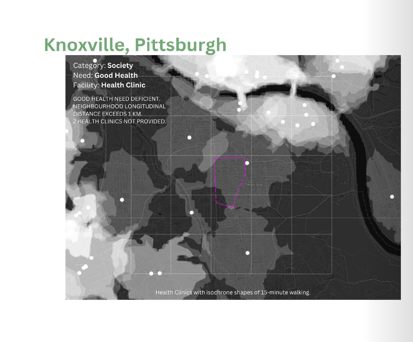
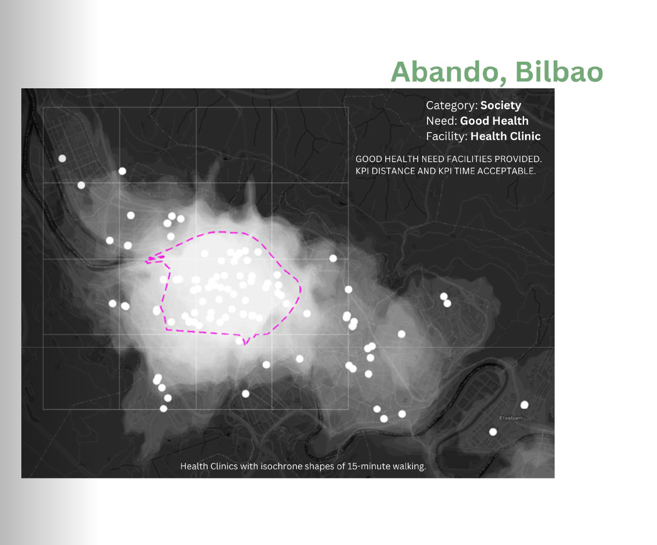
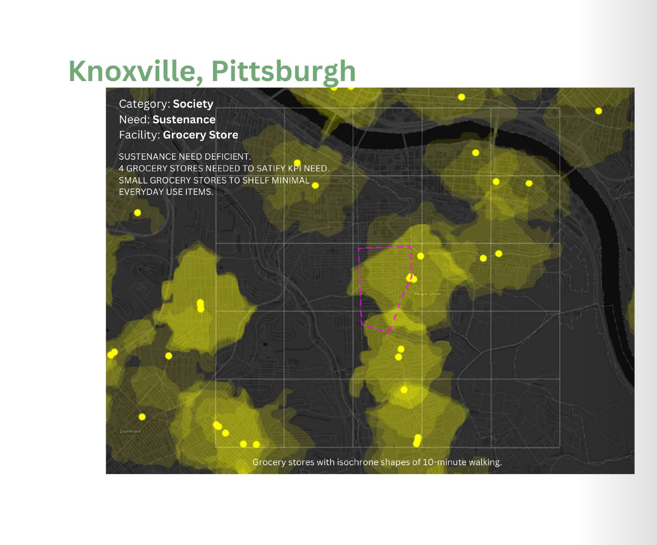
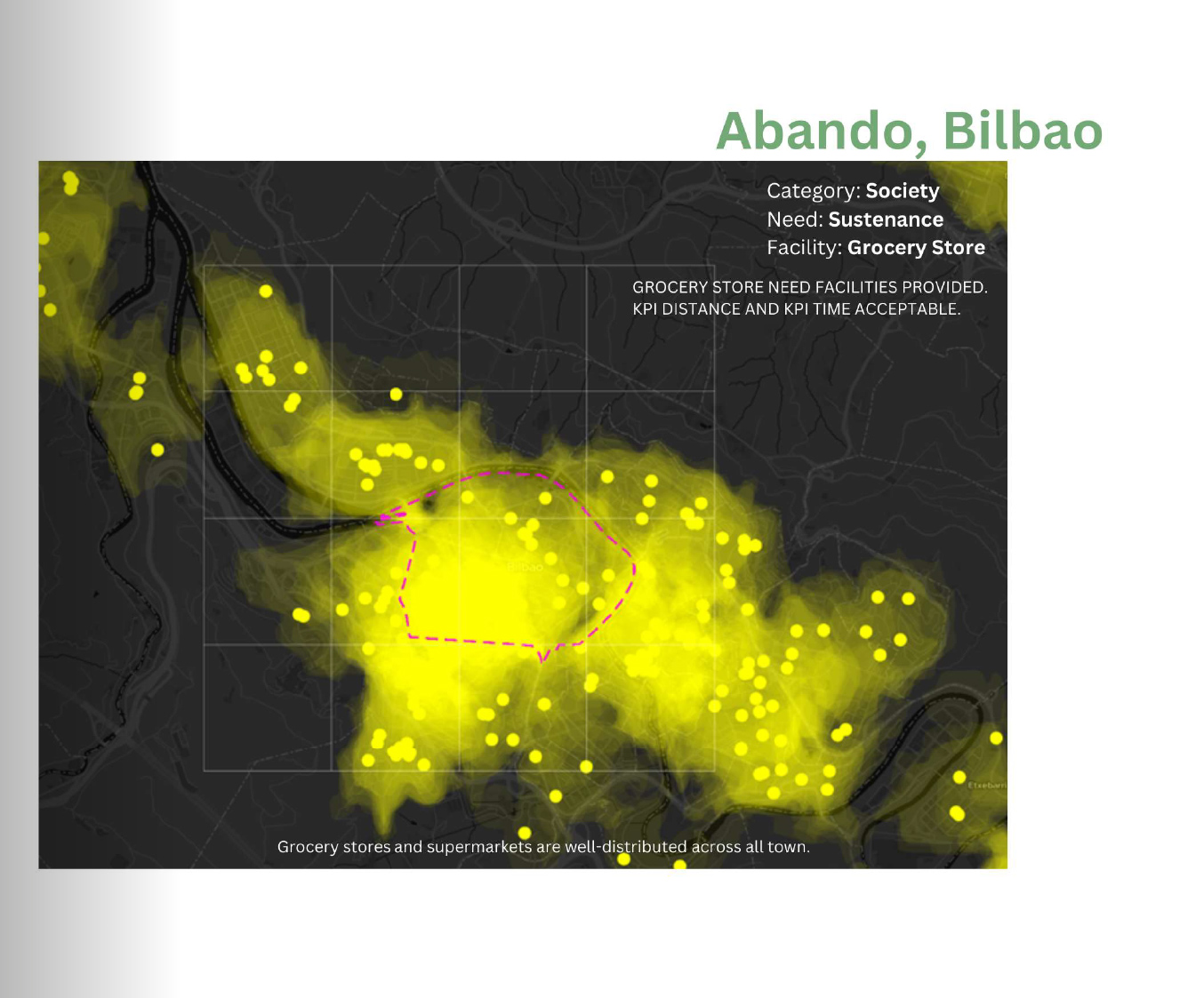
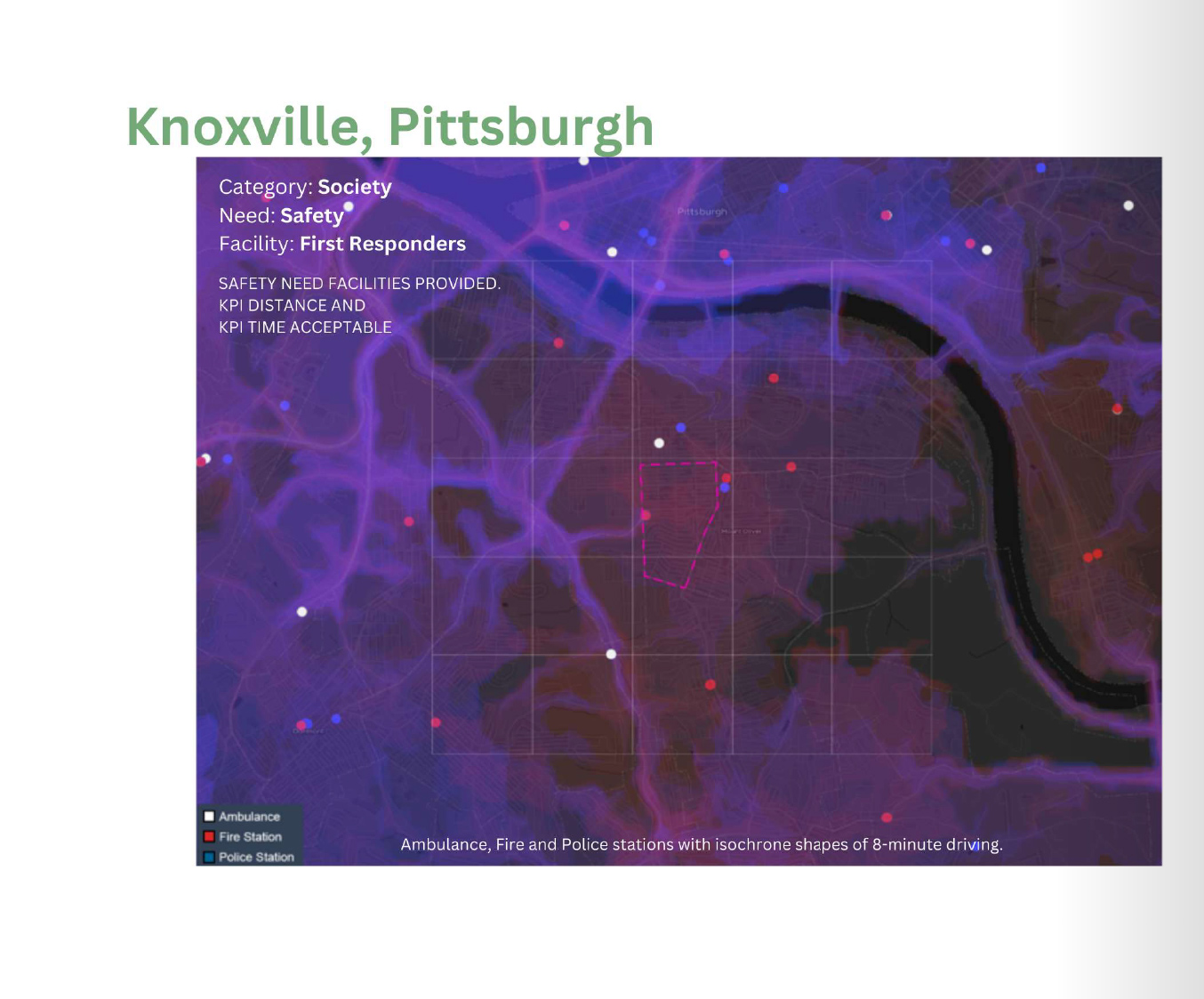
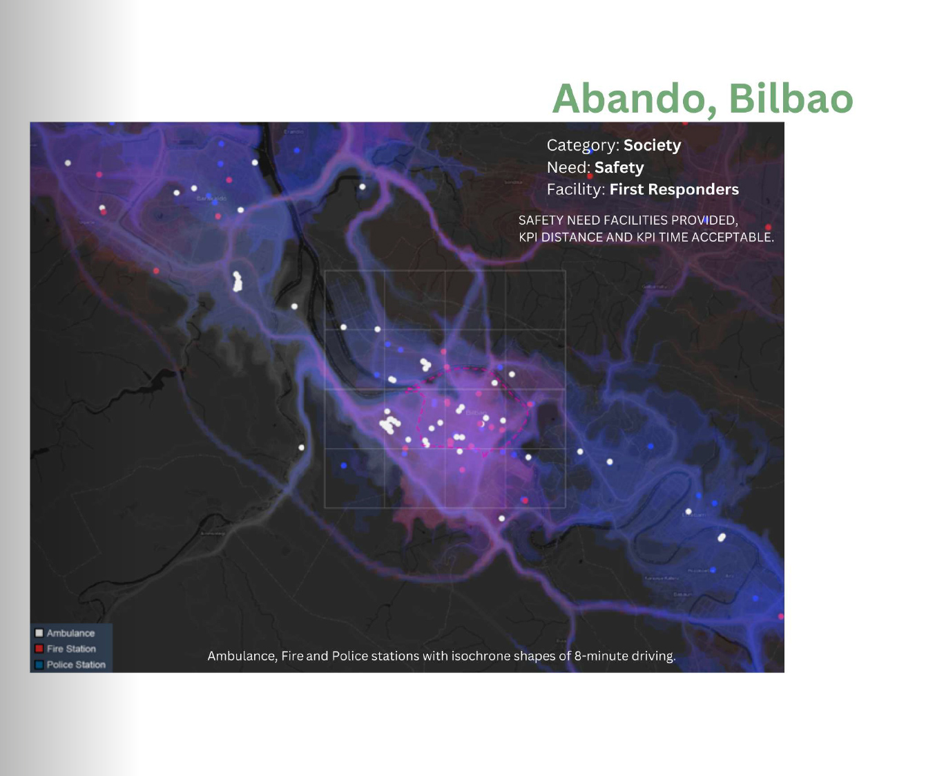
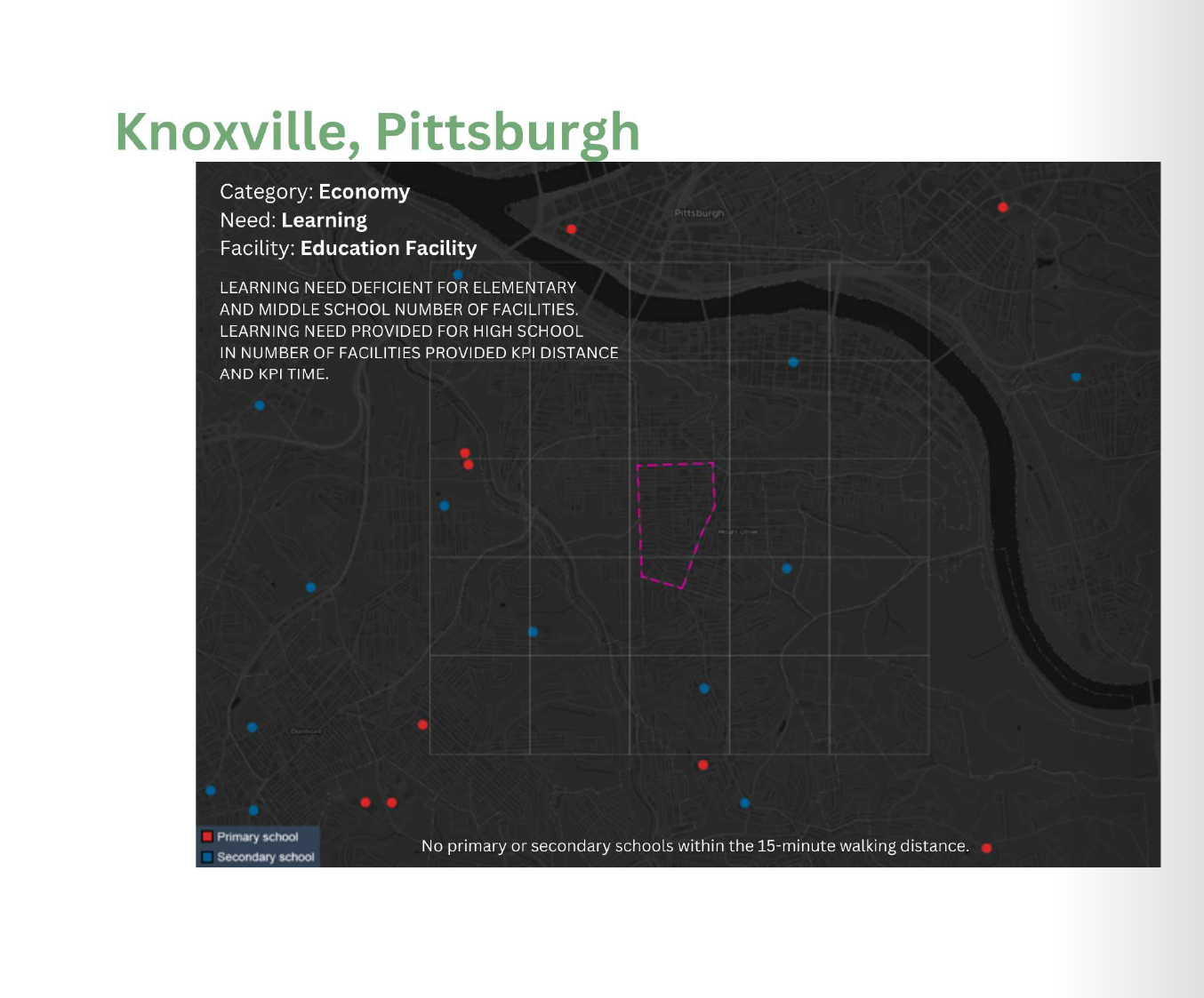
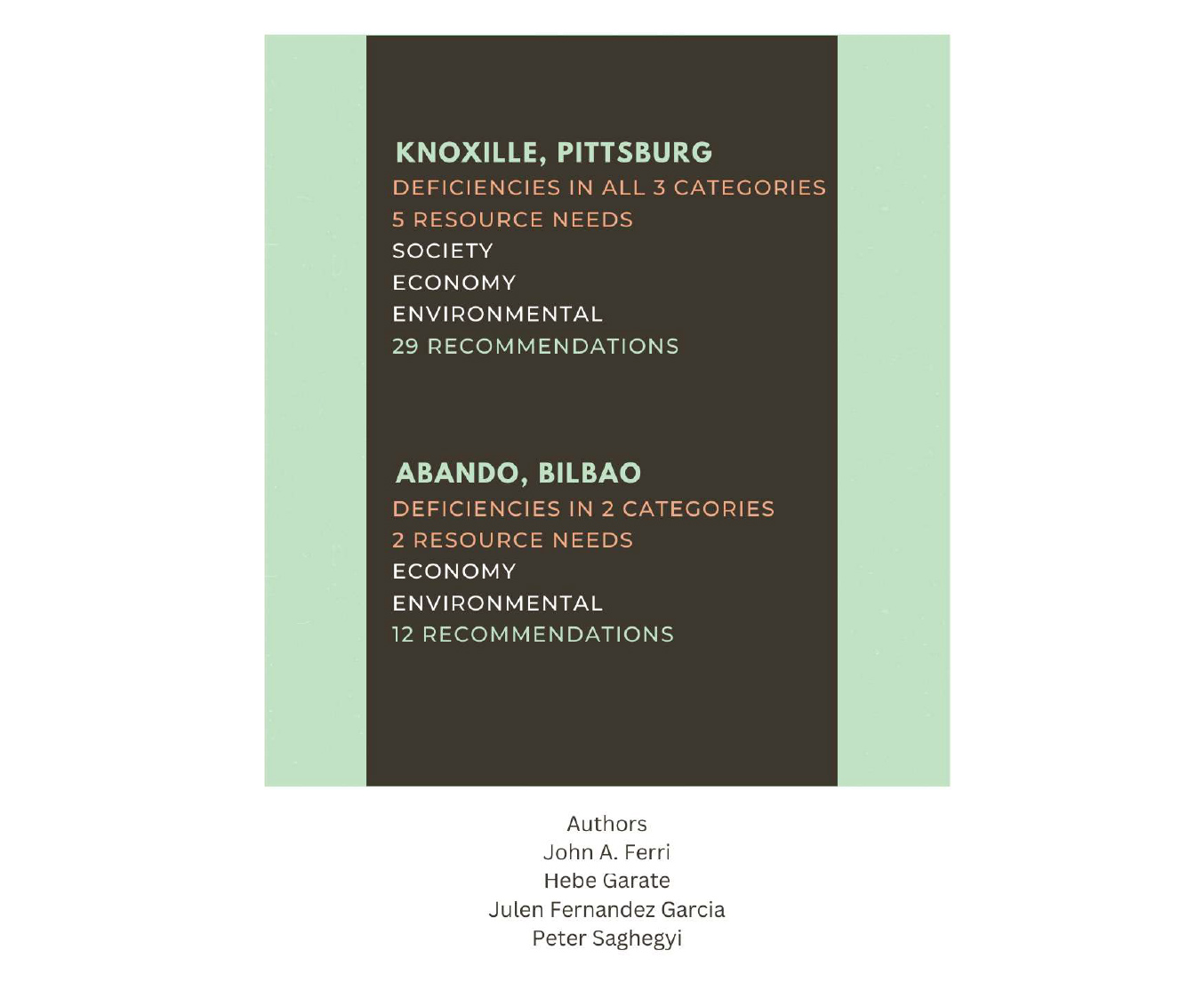
Data visualization converts complex data into easy-to-understand visuals, helping urban planners and decision-makers quickly grasp information and make informed decisions. Our research on Pittsburgh and Bilbao demonstrates that data visualization enables cities to better allocate resources and improve the efficiency of services such as public transportation, healthcare, education, green spaces, and emergency services. This visual data allows council staff to assess and improve the livability and quality of life in the city’s communities.
Exploration-driven interface linked to urban metrics, fostering transparency and cost-effective decision-making.
Council staff should prioritize a user interface that allows them to easily explore all aspects of the city and its neighborhoods. Linking this exploration to established standards and indicators helps staff evaluate whether these areas meet the study’s criteria or fall short. Sharing visualized data with the public makes it easier for residents to understand city operations, promotes collaboration in decision-making, and fosters community engagement and transparency to prioritize smart city initiatives and cost-effectiveness.
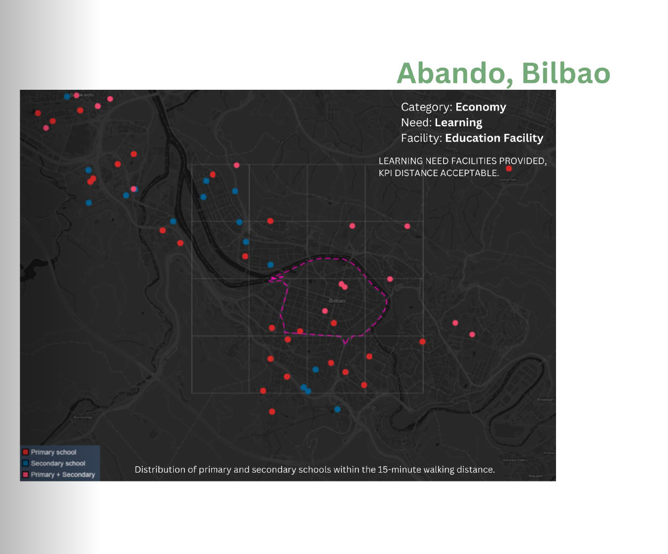
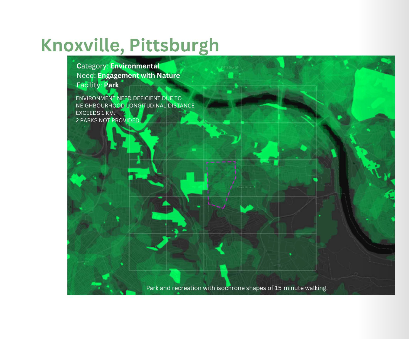
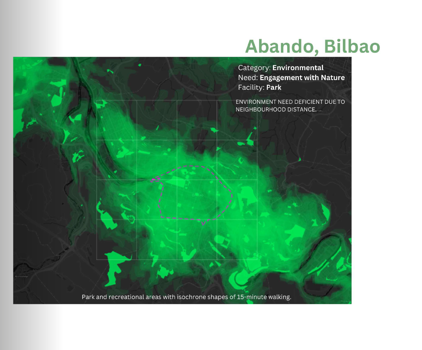
Visual Map Analysis
Neighborhood Minimum Livability Framework
The catalog integrates theory and visualization to analyze differences in quality of life and living standards across neighborhoods. By using graphs and maps, it highlights variations in urban conditions, offering a solid basis for developing public policies.
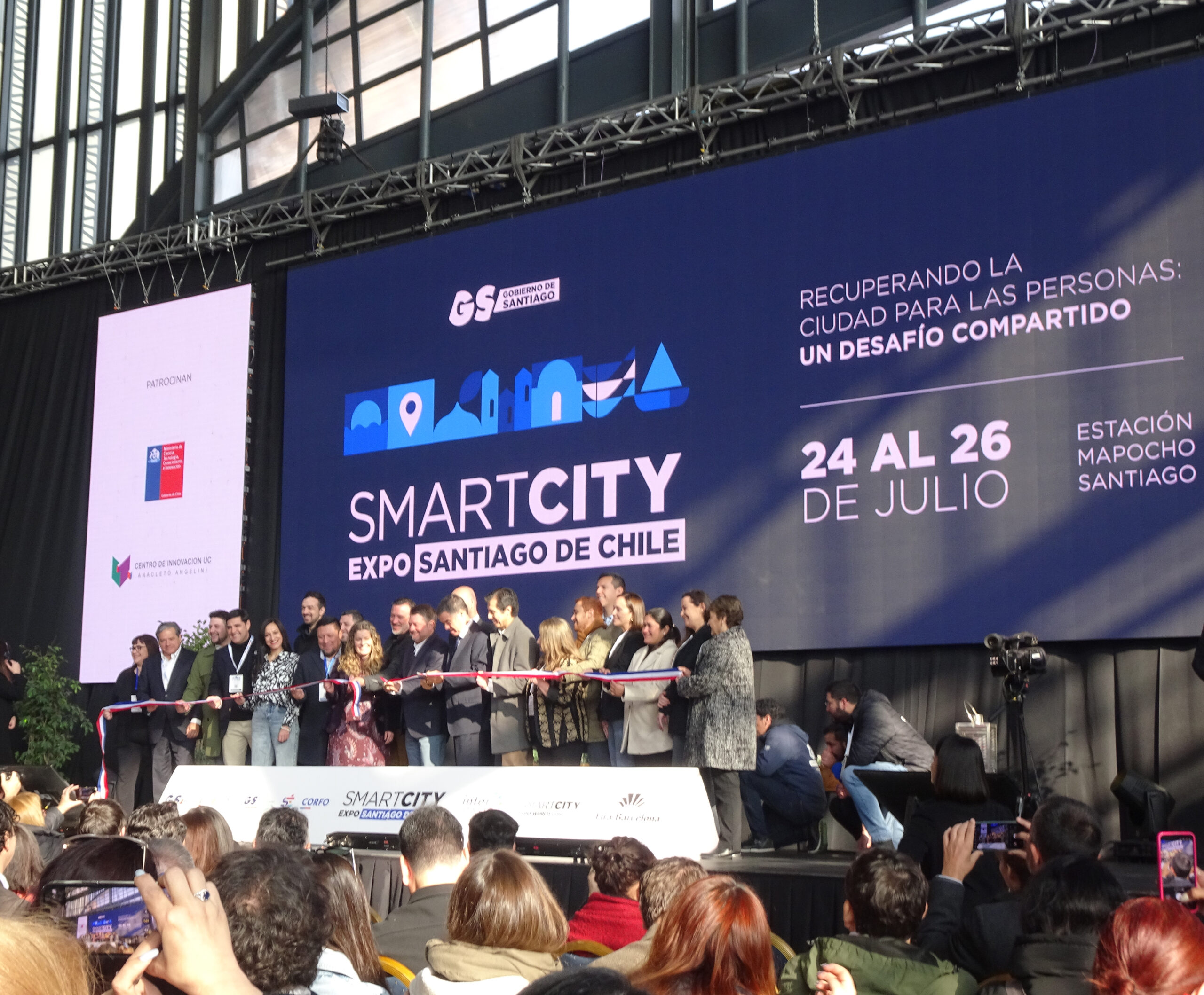
The Smart City Expo Santiago 2025 took place from July 24 to 26 at the Centro Cultural Estación Mapocho in Santiago, Chile, convening urban planners, policymakers, community leaders, and technology innovators from across Latin America and beyond.
The opening session set a powerful tone, reaffirming Santiago’s commitment to inclusive development, urban resilience, and the transformative power of public policy in shaping livable futures. This year’s central theme, “Taking back the city for people: a shared challenge” called for a renewed focus on reclaiming urban spaces to advance equity, well-being, and sustainability.
In addition to the main event, four specialized forums delved into the interconnected aspects of livable urbanism, including Mobility and City Planning, Safe and Resilient Cities, Restoring Nature to the City and Living better.
The International Congress, organized by Fira Barcelona, featured keynote sessions, case studies, and collaborative labs, guaranteeing a dynamic platform for dialogue and knowledge exchange.